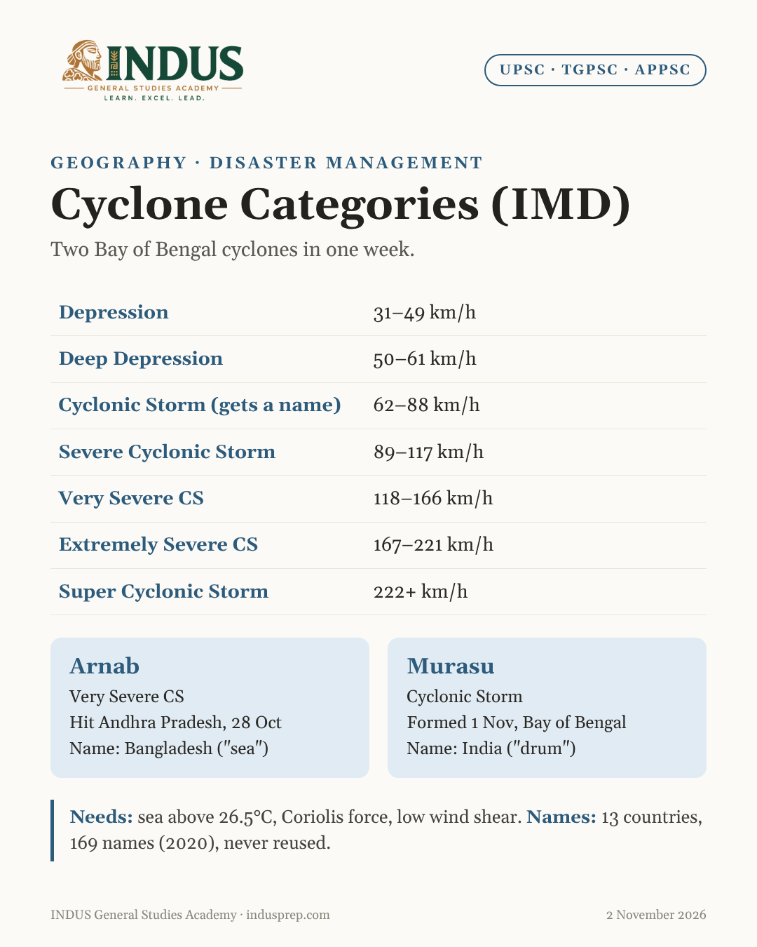
In news
- Cyclone Arnab, a Very Severe Cyclonic Storm, crossed the Andhra Pradesh and Yanam coast on 28 October 2026. It brought very heavy rain to north coastal Andhra Pradesh and southern Odisha.
- Within days, Cyclone Murasu formed over the Bay of Bengal on 1 November 2026. It was forecast to move towards the south Andhra Pradesh coast.
- IMD issued alerts for Andhra Pradesh, Telangana, southern Odisha and northern Tamil Nadu.
The two cyclones at a glance
| Feature |
Arnab |
Murasu |
| Basin |
Bay of Bengal |
Bay of Bengal |
| Peak category (IMD) |
Very Severe Cyclonic Storm |
Cyclonic Storm |
| Landfall |
Andhra Pradesh and Yanam coast (28 Oct) |
Forecast: south Andhra Pradesh coast |
| Name given by |
Bangladesh |
India |
| Meaning |
"Sea" or "ocean" (Bengali) |
"Drum" (Tamil) |
What is a tropical cyclone
- A tropical cyclone is an intense low-pressure system over warm tropical seas.
- Winds spiral inwards towards the centre. They move anticlockwise in the Northern Hemisphere and clockwise in the Southern Hemisphere.
- Its energy comes from the latent heat of condensation released when moist air rises and forms clouds.
How a cyclone forms
Conditions needed
- Warm sea surface: temperature of at least 26.5°C, down to a depth of about 50 metres.
- Coriolis force: needed to make the winds spin. That is why cyclones do not form within about 5° of the Equator.
- Low vertical wind shear: winds at different heights must not differ much, so the storm's vertical structure is not torn apart.
- A pre-existing disturbance: a low-pressure area or a weak wave.
- High humidity in the lower and middle atmosphere.
- Upper-level divergence: air must flow out at the top so that more air can rise from below.
Stages of formation
- Warm, moist air rises from the sea surface.
- The rising air cools and condenses into clouds, releasing latent heat.
- This heat warms the air further, so it rises faster. Surface pressure falls.
- Surrounding air rushes in. The Coriolis force makes it spin.
- The system grows from a low-pressure area to a depression, and then to a cyclone.
- Over land or cold water, it loses its moisture supply and weakens.
Structure of a cyclone
- Eye: the calm, clear centre, with the lowest pressure.
- Eyewall: the ring of tall clouds around the eye, with the strongest winds and heaviest rain.
- Rainbands: spiral bands of cloud and rain moving towards the centre.
IMD classification of cyclonic disturbances
| Category |
Wind speed (km/h) |
| Depression |
31 to 49 |
| Deep Depression |
50 to 61 |
| Cyclonic Storm |
62 to 88 |
| Severe Cyclonic Storm |
89 to 117 |
| Very Severe Cyclonic Storm |
118 to 166 |
| Extremely Severe Cyclonic Storm |
167 to 221 |
| Super Cyclonic Storm |
222 and above |
- A system gets a name only when it becomes a Cyclonic Storm (62 km/h or more).
Recent cyclones in the North Indian Ocean
| Cyclone |
Year |
Sea |
Main area hit |
Name given by |
| Remal |
2024 |
Bay of Bengal |
Bangladesh and West Bengal |
Oman |
| Asna |
2024 |
Arabian Sea |
Gujarat coast and Pakistan (rare August cyclone) |
Pakistan |
| Dana |
2024 |
Bay of Bengal |
Odisha |
Qatar |
| Fengal |
2024 |
Bay of Bengal |
Tamil Nadu and Puducherry |
Saudi Arabia |
| Shakhti |
2025 |
Arabian Sea |
Stayed over the sea |
Sri Lanka |
| Montha |
2025 |
Bay of Bengal |
Andhra Pradesh (near Kakinada) |
Thailand |
| Ditwah |
2025 |
Bay of Bengal |
Sri Lanka and Tamil Nadu |
Yemen |
| Arnab |
2026 |
Bay of Bengal |
Andhra Pradesh |
Bangladesh |
| Murasu |
2026 |
Bay of Bengal |
Andhra Pradesh (forecast) |
India |
How cyclones are named
- Names for the North Indian Ocean are given by the WMO/ESCAP Panel on Tropical Cyclones, which has 13 member countries.
- The current list of 169 names (13 from each country) was adopted in 2020.
- IMD's Regional Specialised Meteorological Centre (RSMC), New Delhi, assigns the names in order.
- A name is never reused.
Why the Bay of Bengal gets more cyclones
- Warmer sea surface and higher humidity.
- Low salinity and freshwater from big rivers keep the surface warm.
- Remnants of Pacific typhoons move in from the east.
- Its funnel shape and shallow coast cause high storm surges.
- Arabian Sea trend: the Arabian Sea is warming fast, and severe cyclones there are becoming more frequent.
Cyclone seasons in India
- Pre-monsoon: April to June.
- Post-monsoon: October to December. This is the peak season for the Bay of Bengal.
Key terms
- Landfall: when the centre of the cyclone crosses the coast.
- Storm surge: an abnormal rise in sea level pushed by cyclone winds. It causes most cyclone deaths.
- Rapid intensification: a sharp jump in wind speed within 24 hours, increasingly common due to warmer seas.
- Recurvature: a change in the cyclone's direction of movement.
- Fujiwhara effect: two nearby cyclones rotating around each other.
Disaster management
- IMD gives early warnings with colour-coded alerts.
- NDMA and NDRF lead preparedness and response.
- National Cyclone Risk Mitigation Project (NCRMP): cyclone shelters, early warning and evacuation roads in coastal States.
- Odisha model: after the 1999 Super Cyclone, Odisha built shelters and evacuation plans that cut deaths sharply.
- Mangroves and shelterbelts act as natural barriers against storm surge.
Way forward
- Improve impact-based forecasting, not just track forecasts.
- Build cyclone-resilient housing and power lines in coastal districts.
- Protect and restore mangroves.
- Provide crop insurance and quick relief for fishers and farmers.
- Prepare for stronger cyclones as oceans warm with climate change.
Exam relevance: UPSC Prelims, GS-1 (Physical geography) and GS-3 (Disaster management); TGPSC, APPSC (Geography, Disaster management).